
search
Tokyo city map
City map of Tokyo. Tokyo city map (Kantō - Japan) to print. Tokyo city map (Kantō - Japan) to download. Tokyo City (東京市 Tōkyō-shi?) was a municipality in Japan and part of Tokyo-fu which existed from May 1, 1889 until its merger with its prefecture on July 1, 1943. The historical boundaries of Tokyo City are now occupied by independent special wards as its shown in Tokyo city map. The new merged government became known as Tokyo, Tokyo Metropolis, or ambiguously Tokyo prefecture.
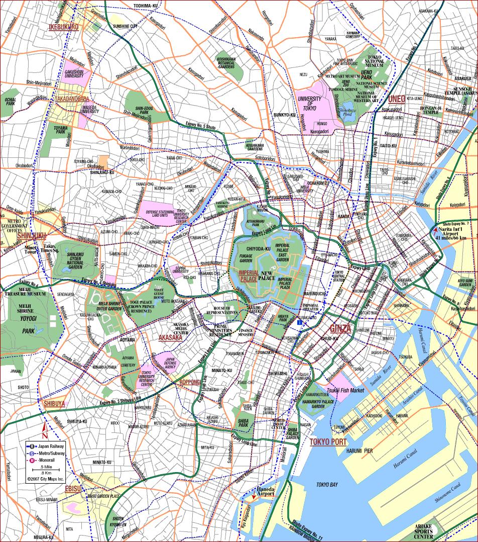
Tokyo City initially did not maintain a separate mayor or city council; instead, the governor of Tokyo Prefecture served as mayor of Tokyo, and each ward had its own assembly. Tokyo city began electing its own mayor in 1898 but retained ward-level legislation, which continues to this day in the special ward system. The city hall of Tokyo was located in the Yūrakuchō district as its mentioned in Tokyo city map, on a site now occupied by the Tokyo International Forum.
Tokyo city has been the administrative center of Japan since the 1600s. Until the 1860 the Emperor exercised only symbolic rule from his palace in Kyoto, while those at the apex of the warrior class ran the country from their castle in Tokyo (see Tokyo city map). In other words, Kyoto was the repository of tradition, Tokyo city the seat of power, an arrangement that persists to this day. Although Tokyo remains the administrative and political center of Japan not to mention having also become its cultural center stray only meters off the yellow brick roads lined with skyscrapers and peopled with perfectly-turned-out creatures off the catwalks, and you will find that the metropolis also has its very down-home side.