search
Keio line map
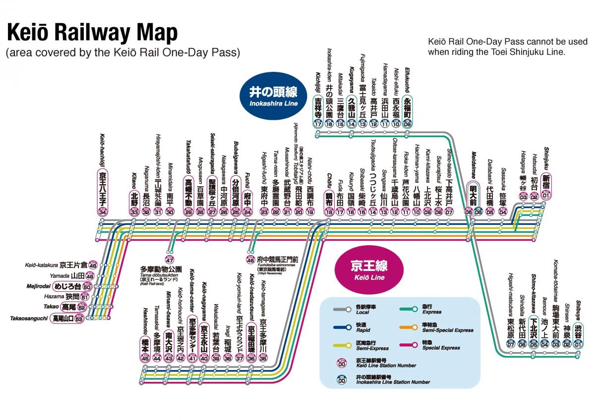
Keio train map. Keio line map (Kantō - Japan) to print. Keio line map (Kantō - Japan) to download. The Keio Line (京王線 Keiō-sen) is a 37.9 km railway line in western Tokyo as its shown in Keio line map, Japan owned by the Keio Corporation. Keio line runs from Shinjuku, Tokyo, to the suburban city of Hachiōji. The Keio Line is part of a network with interchanges and through running to other lines of the Keio Corporation: the Keio New Line, Keio Sagamihara Line, the Keibajō Line, the Dōbutsuen Line, the Takao Line and the 1,067 mm gauge Inokashira Line.
The Keio Line is 37.9 km long and intersects with other Keio Corporation owned lines in western Tokyo and Kanagawa Prefecture as its mentioned in Keio line map: the Keio New Line (Sasazuka Station in Shibuya to Shinjuku Station), Keio Sagamihara Line (Hashimoto Station to Chofu Station), the Keio Keibajo Line (Higashi-Fuchu to Fuchu-Keiba-Seimon-mae), the Keio Dobutsuen Line (Takahatafudo to Tama-Dobutsukoen for Tama Zoo), the Keio Takao Line (Kitano Station to Takaosanguchi Station with access on to Mt. Takao (Takaosan)), and the Keio Inokashira Line (from Shibuya Station to Kichijoji).
The Keio Line began in 1913 with the completion of the Shinjuku to Chofu section extending to Fuchu in 1916. Extensions on the Keio Line continued from the 1960 through the 1980's. The Keio Line was the first railway company in Tokyo to introduce special carriages for women back in 2000. Five types of rapid services are operated on the Keio Line, along with local trains. Destinations are from Shinjuku unless noted as you can see in Keio line map.


