search
Keiyo line map
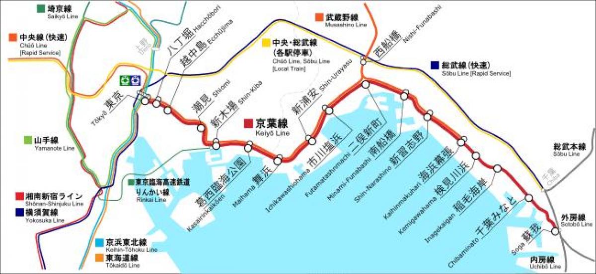
Map of Keiyo line. Keiyo line map (Kantō - Japan) to print. Keiyo line map (Kantō - Japan) to download. The Keiyo Line (京葉線 Keiyō-sen?) is a railway line connecting Tokyo and Chiba in Japan, running mainly along the edge of Tokyo Bay as its shown in Keiyo line map. Keiyo line is operated by the East Japan Railway Company (JR East). Keiyo line provides the main rail access to the Tokyo Disney Resort and the Makuhari Messe exhibition center. The terminus at Tōkyō Station is located underground, some distance to the south of the main station complex approximately halfway to Yūrakuchō Station. This means transfer between other lines at Tokyo Station can take between 15 and 20 minutes.
The name Keiyo is derived from the second characters of the names of the locations linked by the line, Tōkyō (東京?) and Chiba (千葉?). Keiyo line should not be confused with the Keiō Line, a privately-operated commuter line in western Tokyo as its mentioned in Keiyo line map. Keiyo Line local trains stop at all stations between Tōkyō and Soga except Nishi-Funabashi.
The Keiyo Line was initially planned as a freight-only line. Keiyo line first section opened in 1975 as a link between the Chiba Freight Terminal Station (now the Mihama New Port Resort between Inage-Kaigan and Chiba-Minato Stations as you can see in Keiyo line map) and the JFE Steel factory near Soga Station. Passenger service of Keiyo line began in 1986 between Nishi-Funabashi and Chiba-Minato, and was extended eastward to Soga and westward to Shin-Kiba in 1988.


