search
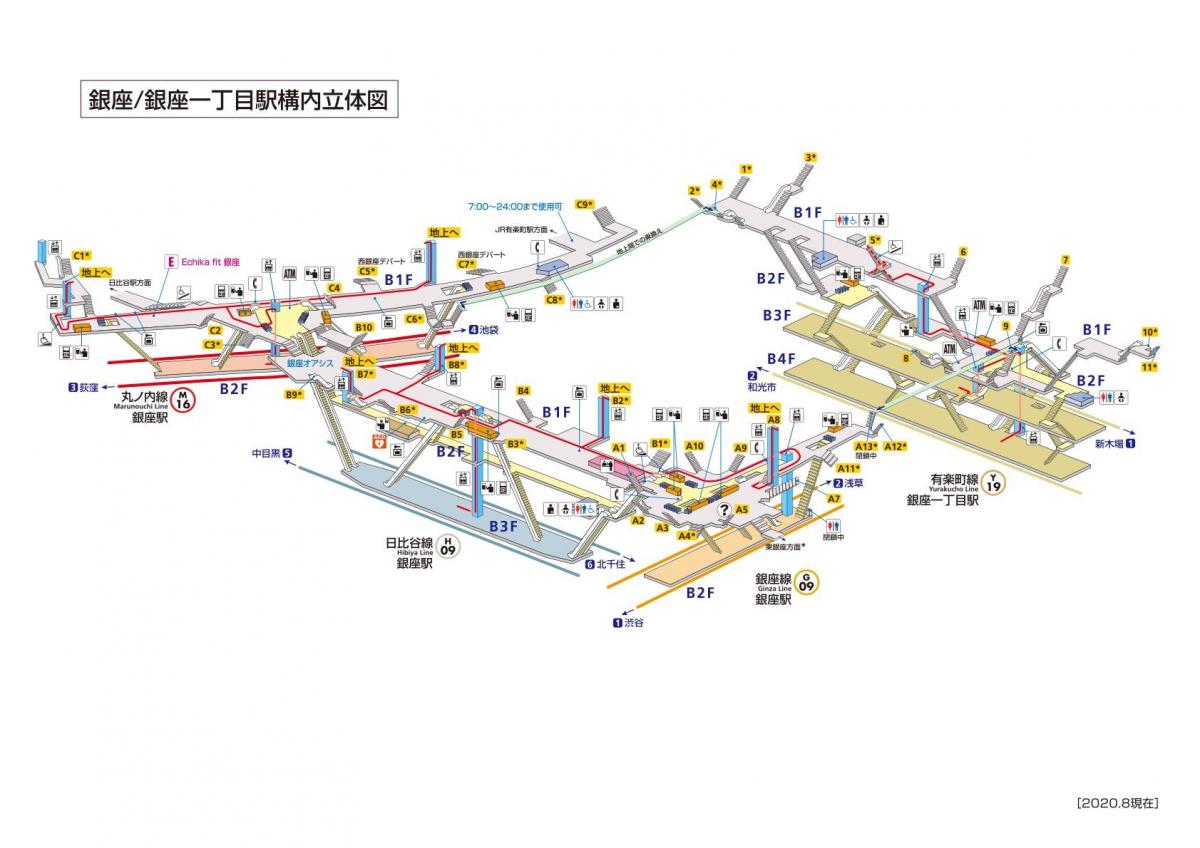
Ginza station map
Map of Ginza station. Ginza station map (Kantō - Japan) to print. Ginza station map (Kantō - Japan) to download. The Hibiya Line platform, which runs east-west between the north-south Ginza Line and Marunouchi Line platforms, was actually built before World War II as part of a planned TUR line to Shinjuku. Ginza station lines are: Tokyo Metro Ginza Line (G-09), Tokyo Metro Marunouchi Line (M-16), Tokyo Metro Hibiya Line (H-08) as its shown in Ginza station map. Each line in Ginza station has an island platform serving two tracks.
An underground passage in Ginza station connects with the following stations, allowing transfer on foot as its mentioned in Ginza station map: Ginza-itchōme (Tokyo Metro Yūrakuchō Line), Higashi-Ginza (Tokyo Metro Hibiya Line, Toei Asakusa Line), Hibiya (Tokyo Metro Hibiya Line, Tokyo Metro Chiyoda Line, Toei Mita Line), Yūrakuchō (Tokyo Metro Yūrakuchō Line, Yamanote Line, Keihin-Tōhoku Line).
There are 19 stations on the Ginza Line, each with its own code beginning with G. You can get to Ginza Station on the Tokyo Metro Ginza Line, Marunouchi Line and Hibiya Line as you can see in Ginza station map. Ginza-Itchome Station on the Yurakucho Line and Higashi-Ginza Station on the Hibiya Line will also get you close. You can walk to the Ginza area in five minutes from JR Yurakucho Station, and in around 15 minutes from Tokyo Station.


