
search
Shinjuku gyoen park map
Map of Shinjuku gyoen park. Shinjuku gyoen park map (Kantō - Japan) to print. Shinjuku gyoen park map (Kantō - Japan) to download. Shinjuku Gyoen National Garden (新宿御苑 Shinjuku Gyoen) is a large park with an eminent garden in Shinjuku and Shibuya, Tokyo, Japan as its shown in Shinjuku gyoen park map. Shinjuku gyoen park was originally a residence of the Naitō family (daimyo) in the Edo period. Afterwards, Shinjuku gyoen park became a garden under the management of the Imperial Household Agency of Japan. Shinjuku gyoen park is now a park under the jurisdiction of the national Ministry of the Environment.
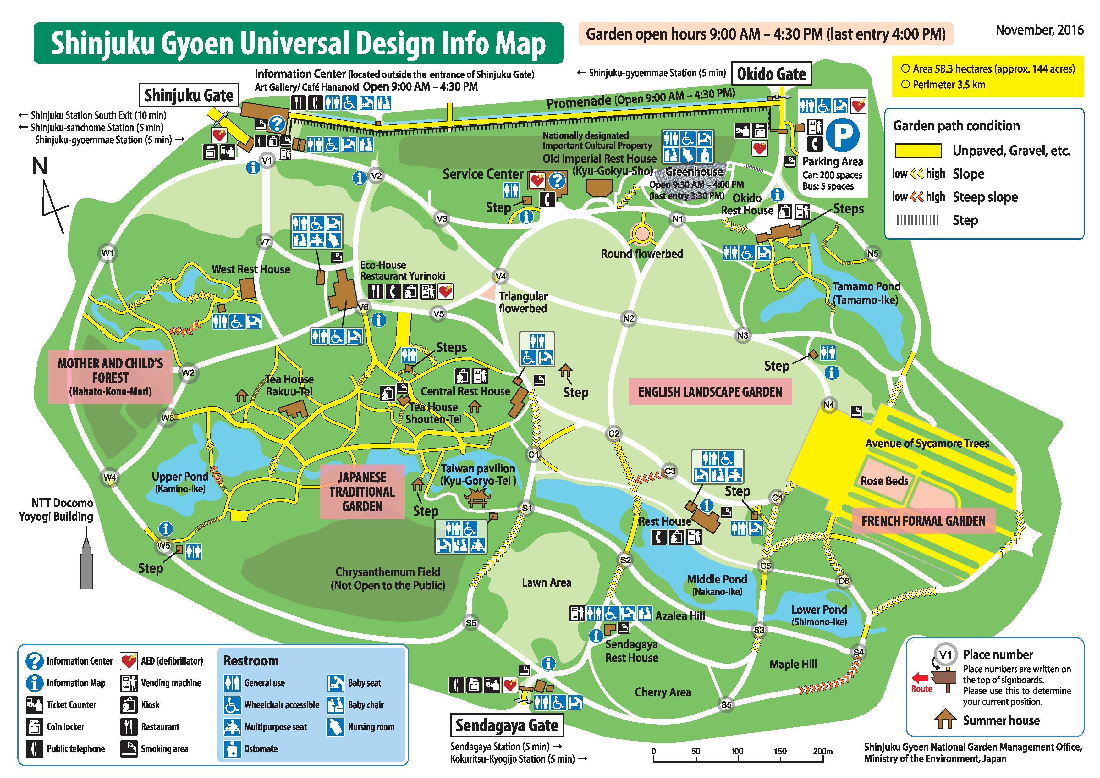
The gardens of Shinjuku gyoen park, which are 58.3 hectares in area with a circumference of 3.5km, blend three distinct styles: French Formal, English Landscape and Japanese traditional as its mentioned in Shinjuku gyoen park map. A traditional Japanese tea house can be found within the gardens of Shinjuku gyoen park. The gardens have more than 20,000 trees, including approximately 1,500 cherry trees which bloom from late March (Shidare or Weeping Cherry), to early April (Somei or Tokyo Cherry), and on to late April (Kanzan Cherry). The gardens in Shinjuku gyoen park have three access gates: Shinjuku Gate, Okido Gate and Sendagaya Gate. Shinjuku Gyoen is open from 9:00 until 16:30.