
search
Yamanote line map
Tokyo Yamanote line map. Yamanote line map (Kantō - Japan) to print. Yamanote line map (Kantō - Japan) to download. The trains that circulate on the Yamanote line are approximately 200 metres long and pass with a frequency of beteen 2 and 4 minutes. The Yamanote line is the most important train line in Tokyo, a circular elevated line operated by the Japan Rail company. The time Yamanote line takes to make a complete tour of the city (35 km) is approximately an hour as its shown in Yamanote line map.
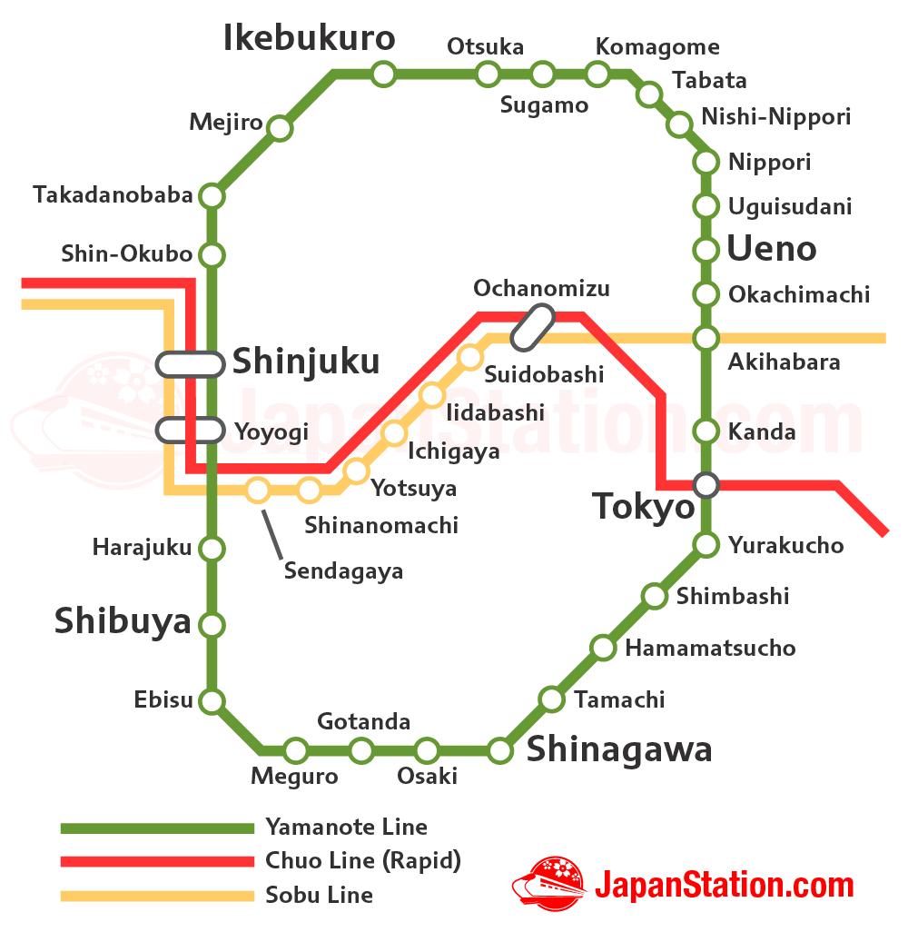
The Yamanote line consists of 29 stations, and its first service began to operate in 1885, 40 years before the metro as its mentioned in Yamanote line map. Today more than 3.5 million people use the Yamanote line service every day. Just as with the metro, the price of the Yamanote line varies depending on the distance travelled. The cost varies between ¥ 140 (US$ 1.30) and ¥ 260 (US$ 2.50), and the most common price is 160 yen.
The Yamanote Line (山手線, Yamanote-sen) is Tokyo most important train line. Yamanote line is a circular line which connects Tokyo major city centers as you can see in Yamanote line map. A trip around the whole circle takes approximately one hour. Even though a single train on the Yamanote Line is roughly 200 meters long, there are departures about every two to four minutes in each direction.
The Yamanote Line is in fact a circular loop-shaped line that connects all the subway lines and also connects the main urban centers of Tokyo as its shown in Yamanote line map. In addition, Yamanote line is the only line that connects all of Tokyo most famous central stations such as Shibuya, Shinjuku, Ikebukuro, Ueno and Tokyo Station. The total length of Yamanote line is 34.5 km and it takes about an hour to complete the whole tour.