
search
Tokyo rail map
Japan rail map Tokyo. Tokyo rail map (Kantō - Japan) to print. Tokyo rail map (Kantō - Japan) to download. Tokyo, as the center of the Greater Tokyo Area, is Japan largest domestic and international hub for rail, ground, and air transportation. Public transportation within Tokyo is dominated by an extensive network of clean and efficient rails and subways run by a variety of operators as its shown in Tokyo rail map, with buses, monorails and trams playing a secondary feeder role.
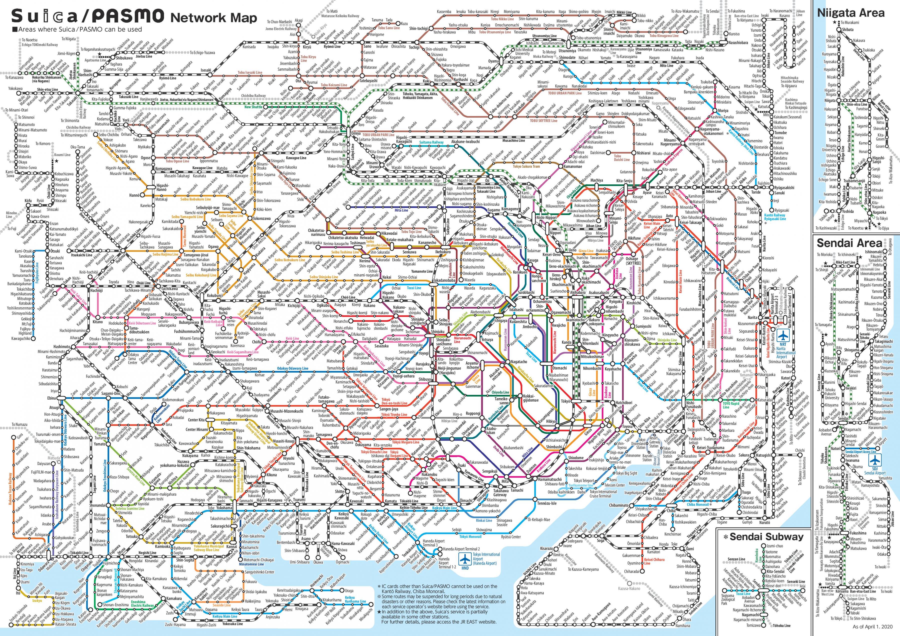
Rail is the primary mode of transportation in Tokyo, which has the most extensive urban railway network in the world and an equally extensive network of surface lines. JR East operates Tokyo largest railway network, including the Yamanote Line loop that circles the center of downtown Tokyo as its mentioned in Tokyo rail map. Two organizations operate the subway network: the private Tokyo Metro and the governmental Tokyo Metropolitan Bureau of Transportation.
In Tokyo, the distances are always greater than you think. If on the map the rail stations seem to be close to each other, it still takes about 20 to 30 minutes to walk from Shibuya to Harajuku and more than 2 hours from Shibuya to Ginza as you can see in Tokyo rail map. Although tourists tend to prefer the train, the bus is often a good alternative to rail.
Train transportation in Tokyo refers to JR (Japan Railway) lines, Tokyo Metro, Toei Subway, and other railway companies that operate in and around the metropolitan area as its shown in Tokyo rail map. Learn which railway service to use for your travel needs, as well as about cost-efficient travel passes available on each line of Tokyo rail.