
search
Tokyo train map
Tokyo train station map. Tokyo train map (Kantō - Japan) to print. Tokyo train map (Kantō - Japan) to download. Tokyo is covered by a dense network of train, subway and bus lines, which are operated by about a dozen different companies. The Tokyo train lines operated by JR East and the subway lines are most convenient for moving around central Tokyo as its shown in Tokyo train map. The Japan Rail Pass and JR Tokyo Wide Pass are valid only on JR trains and the Tokyo Monorail. They cannot be used on subways or any other non-JR train.
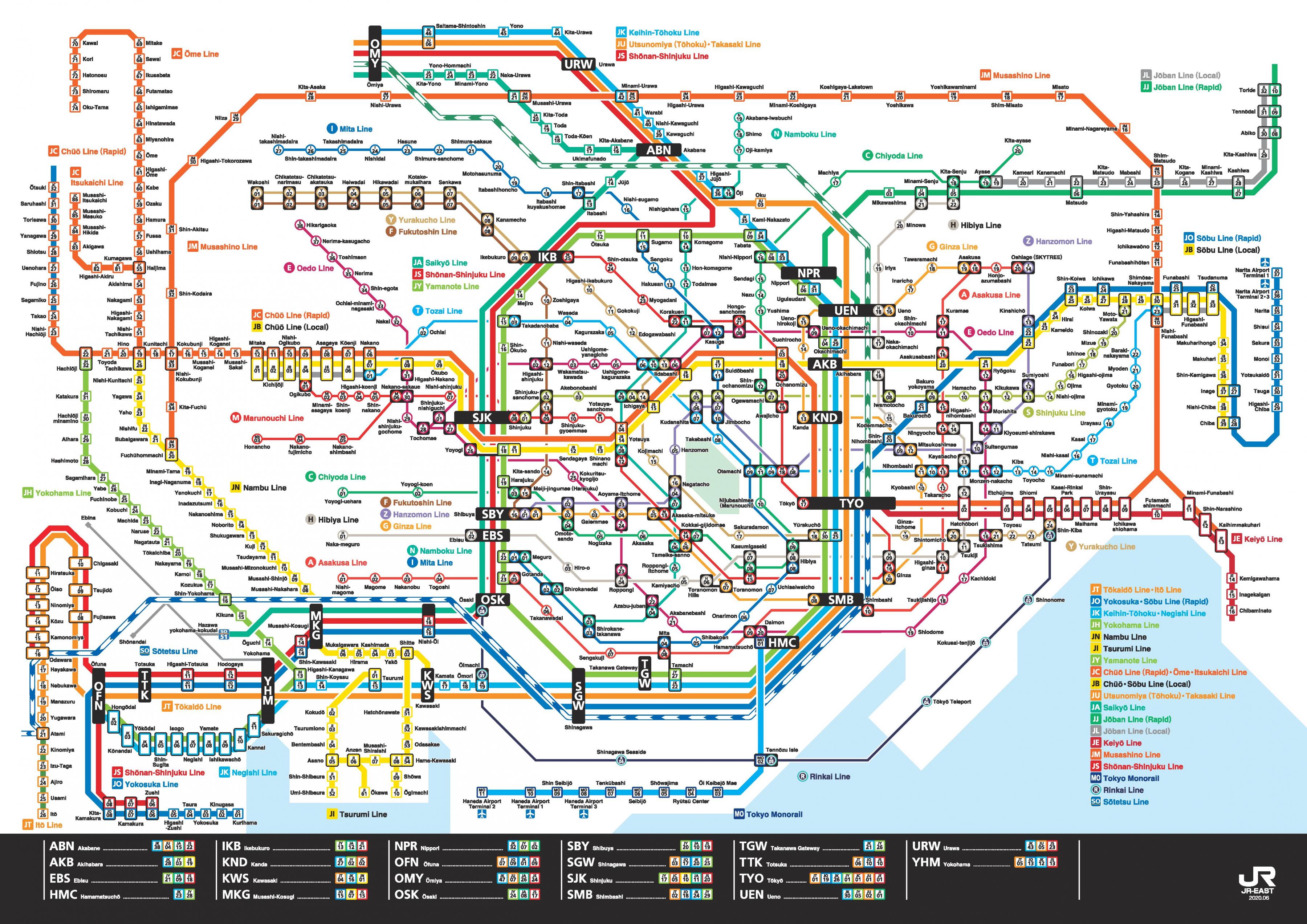
Tokyo most prominent train line is the JR Yamanote Line, a loop line which connects Tokyo multiple city centers as its mentioned in Tokyo train map. Tokyo 13 subway lines are operated by two companies and run largely inside the Yamanote circle and the areas around Ginza and the area east of the loop line. Most of the many Tokyo suburban train lines commence at one of the six major stations of the Yamanote Line (Tokyo, Ueno, Ikebukuro, Shinjuku, Shibuya and Shinagawa).
Tokyo trains of some subway lines continue to operate on the tracks of different companies on suburban train lines as you can see in Tokyo train map. For example, the Chiyoda Subway Line is directly connected with the suburban Odakyu Line at Yoyogi-Uehara Station, and trains on the Fukutoshin Subway Line continue to run on the tracks of the Tokyu Toyoko Line at Shibuya Station.
JR is responsible for the shinkansen bullet train, a backbone connecting major Japanese cities, as well a network of rail that connects metro areas with rural ones. While sightseeing in Tokyo, you will find yourself using the Yamanote Line quite often. If you plan on going to Tokyo suburbs and outer areas, limited express trains are recommended as its shown in Tokyo train map.